Search This Blog in the above block
~ I dont blog about things to be liked. I blog about things that I like ~ ... so that one day, on my death bed, I will have said and done what I wanted to do, and die peacefully without regrets.
Live your life in such a way that when your feet hit the floor in the morning, Satan shudders & says..' Oh shit....She's awake'

Sunday, September 26, 2010

Wolfberg Cracks - Part 2: Finding the Crack

Panorama of Sanddrif Valley.
(Click on images for enlargement
all images by Alex Aitkenhead)

To get to this part of the hike, we drove for 4 hours from Cape Town, and spent the night at Oasis Bed and Breakfast.  Then we drove another 22km to get our permits at Sanddrif Wine Farm, and our final 2km to get to the parking area and the start of this route.

I had been waiting for 2 years to do this route.  There was always something that stopped me from doing it. Alex and I were both very excited to finally get here and start the trek up this gauntlet.


This part of the route is fairly simple:  Follow the path to the top.

It was not long before our car became a small speck in the car park below.


After walking for 45 minutes, you will reach this massive square rock.  This marks the halfway spot in your up route in terms of time.


The tricky part of the route starts here.  I have marked the rocks in the picture below to help you should you wish to follow this route yourself.
1,2,3 are bolders that have rolled down and blocked the path up.  This is where you need to find your way around the right of boulder 3 and get to the back of it and aim in the direction of point 4 behind it.
(Note: if you pass the left of boulder no.1,  you can also climb up the easy route to the top (follow the sign).  This is not recommended, as you will be missing out on the most special part of this route). 
4. Here you are faced with a 2.5m (90 degree) climb onto the ledge leading to point 5.  But first get yourself to point 4.


Once you have reached point 4. A short scramble to the top will take you onto a easy ledge.


Follow the ledge to the end, turn left at the end.  Be careful as there is one section where the ledge is not wider than an A4 size paper.  It gets better immediately after this point.


A short scramble will take you to a massive arch in front of you.  Once you reach the arch, scramble between the rocks marked 1 & 2 into a beautiful rock-filled amphitheater.


In the picture below, the amphitheater is show to be about 20m in width.  Scramble over the rocks, directly across and opposite the arch.  Do not take the more obvious (but not easy) route to your right (more or less where the people are standing in the picture).  Rather walk across in the direction of where this photo was taken from.  Im sorry to not have taken a picture of this, but for now this is the best that I can do here.


You will be walking towards a massive rock cave, seen in the image below.

Above pic sourced from lastfrog.co.za

Enter this cave on its left side.  Its a tight squeeze for 6m of darkness.  But you are able to see the light on the other end, the moment you enter the cave.  Be careful, and best to switch on your petzl lamp on this tiny part of the route.

The next section of this route took us into the most beautiful rock formation hidden deep into this mountain.

Wolfberg Cracks - Part 3: Adventures inside the Crack

The fun began here.  Entering this passage was the start of a 200m adventure into the mountain.

This is a dark narrow passage of about 6m long.


The other side of the passage brings you to a sandy spot where the party can re-group before the next adventure.  Make sure you bring your Fisheye lense- if you have one!  (We forgot ours at home, so its another reason for us to just have to come back here again) - jeay!


venture around as much as possible and enjoy the moment for what it has to offer. stop somewhere here and have lunch, and give yourself time to really look around.

to get to the next level, keep to the right of the crack...


crawl under this large rock to the next section of the passage...


The arches and rock formations are like some of my friends would say: "to die for darlin'!"


The chief happy snapper taking a break ...  (he was fired from all and any navigational duties, but he is still allowed to take snaps) ~ LOL


Soon the crack is split into 2.  This is where you must take the left passage at this section as seen in the pic below.


Alex, the love of my life,  doing what he loves doing :)


The passage is very long and becomes narrower as you walk into it.


Once you reach what seems to be a dead end, don't despair.  But its a tricky 2m scramble to the top of this rock.  This is a link to an image of an easy way to get up.


Once you have reached the top of this rock, after 5m you will notice your last obstacle before you exit this crack.  Its a trapped rock.  You need to lie on your back, and go head first into the hole.  Its the only way you will be able to get your body out on the other side.  See the graphic of the image below on how to do this.


This lady is about to get through this trapped rock.  Its very easy and thousands before you have done it already.  So don't be afraid.  Leave your city fears behind you and Just Do It!


Within 2 minutes of walking you reach the top of this crack.


In the image below I looked back into the crack.  All you can see from here is the thin and narrow split in the mountain ...


Find a spot to enjoy the view and have a quick coffee break before you head off to your next adventure.


From here you have 2 choices:
1. Go back down.  (We came from the crack behind me to my right. The way down is the bushy patch on my left.) 1h30min to get back down.
2. Follow the clearly marked path to the Wolfberg Arch.  Please see Wolfberg Cracks: Part 4.  3 hours needed for this section to get back here.

Wolfberg Cracks - Part 4: Heading to Wolfberg Arch

If you come to hike in the Cederberg, be sure to be entertained by the most beautiful rock formations.

The weather was perfect for us (late September), with a crisp breeze blowing the whole day, the hot sun to keep us warm, and the most beautiful blue sky.

All images by Alex Aitkenhead.
Click on images for larger views or go to Alex's blog for desktop sizes.
Immediately as we came out of the cracks, we could see the Wolfberg Arch in far the distance.  This was the last time we saw it, for about another 45min of walking.


To get to this point, (The Sign Wolfberg Arch), we hiked up the mountain, then chose to go through the very scenic Cracks.  After a short coffee break at the top of the cracks, we walked in the direction of the Wolfberg Arch, down towards the end of the small valley that we found ourselves in.  We were told by our virtual guide (Gerrit) that this is the exact point that we have to mark very clearly.  He said the following:

When you get to the end of the valley and see the sign, immediately turn left and go around the rocks. Notice a path going down the mountain again.  Clearly make a marker here for yourself, so that upon your return from the Wolfberg Arch, you will know exactly where to go down.  This will be your down route, also known as the easy way up and down.  He said: "be sure to take the easy way down, because you will need it and there will not be time for you to try and find it when you come back to this point".

So we made our mark.  And then turned towards the sign and the obvious path going towards the Wolfberg Arch.


This route was very easy to follow as all you needed to do was keep your eye on the cairns built by the thousands of hikers who have made this route before us.  Thanks to those who have contributed to making this route such a pleasure to follow!


All that you can hear is the sounds of nature, and sometimes you are reminded about the beauty of silence too. 


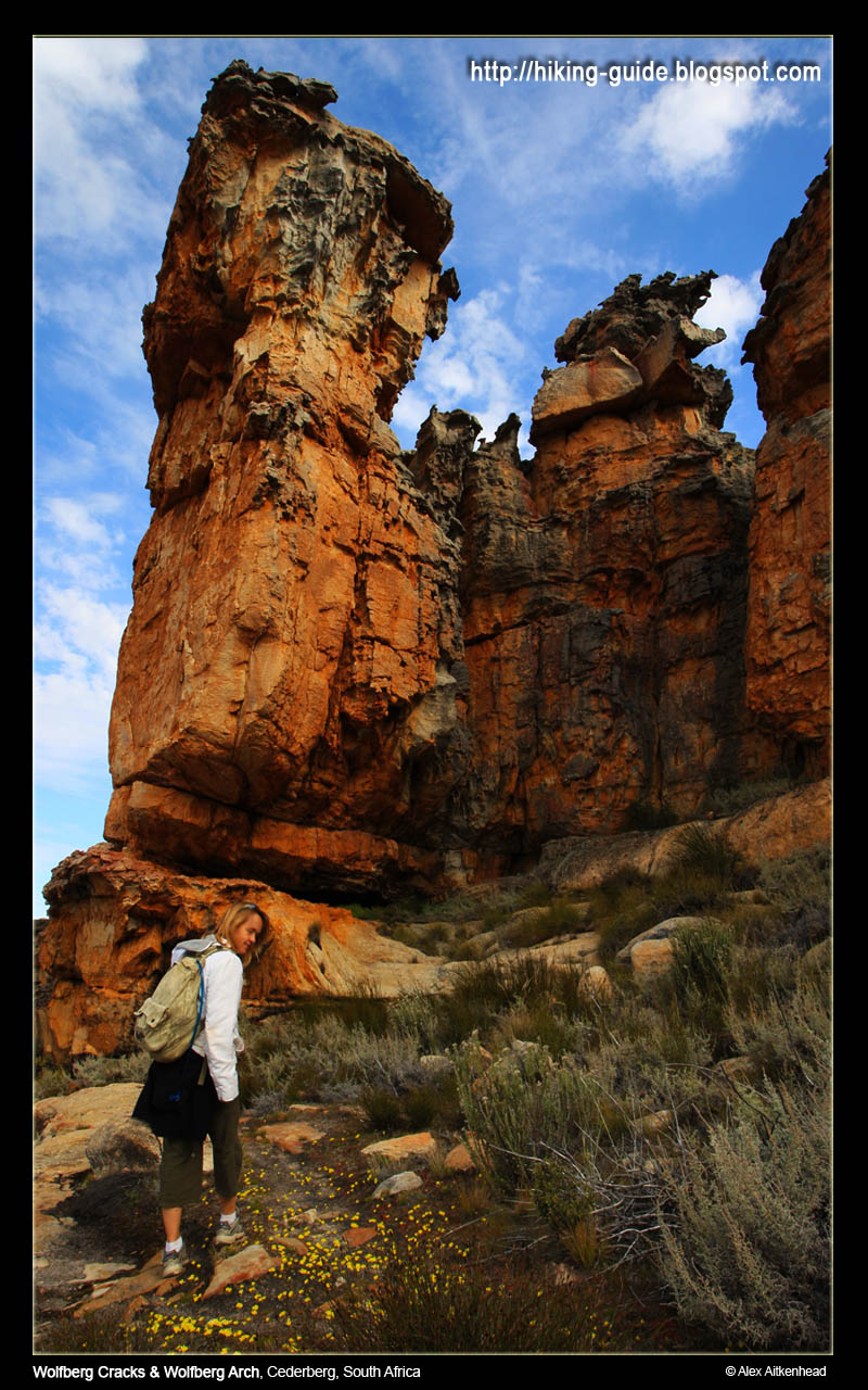
It would be sin to not notice these giants molded to perfection by time :)


This must be the first hike I have ever been on, where I can see our destination for almost the entire way.


It felt like it was never getting any closer!


Aaaaahhhh, the end is near...  (eh, well, this end)


Jeay!  We made it. Easy peasy.


Alex taking all sorts of weird pictures, while Im doing what normal people do when they get to their destination: chill and enjoy the view.


He took so many nice pictures, I decided to load them all!  Thanks Al :)


Due to time constraints, we could not stay too long.  30mins was our mark.  Its 15h30 and time to head back to make our way back down the mountain.  We have enough time, but we are scraping it fine.


After walking at a pace, it took us about 1h00 to get back.  We hardly stopped for photo's to catch up on some time and reached the cracks at 16h00.  Both of us were exhausted but pushed on to commit to our final stage of our fabulous journey.


Read on about how we made it down the mountain ...

Wolfberg Cracks - Part 5: The Easy Route Down


Having come from the Wolfberg Arch, we wanted to be back down by at least 18h00. By this time I was exhausted and decided to take a slow pace down.

We returned to the Wolfberg Arch sign, then we went to look for our marker that we planted before we left, and we were comfortable to know we were going down the right way.


The path is very clear, so it was not difficult to find at all.  No need for describing where to go, again the cairns were a blessing.


At this point I decided to take short 5 min break, to regain some strength to head forward.  Its almost more difficult to stop, because then your legs become lazy from being so tired.  My feet were hurting more than anything by now.


The picture below is showing the last stretch of the easy down-route (6) of the crack. I only inserted it to give the readers an understanding of this is where your path splits when you go up (5), and again the path that you come back to when you come down from the other side.  (The picture is of me going up, so dont let it confuse you if you wish to use this article as a guide.)


How do you climb a mountain?  1 step at a time.  I had to remind myself:  "its the same for getting back down - 1 step at a time".


We reached the car at 18h00.


And were spoilt for choice again with the most beautiful of beautiful sunsets over the Cederberg!


The memories of this hike will surely last forever.  Alex is the most wonderful hiking partner, and he pushes me all the way.  I enjoy being challenged and would not want it any other way either.

Thanks again to Gerrit at Oasis for being our virtual guide all the way!

We really would love to come back and do this route again some day in the near future.  We will be bringing our mountain bikes with us and stay for longer.  Maybe next September again?!

Monday, September 13, 2010

Free access to South African National Parks 13 - 17 Sept 2010

Media Release: Free access to National Parks starts this week

From Monday, 13 September until Friday, 17 September, the country’s body charged with the management of national parks, South African National Parks (SANParks) will allow locals with valid identity documents an opportunity to spend a day at a national park of their choice free of charge.

The week-long campaign giving free access to the national parks will be applicable to all the national parks managed by SANParks, with the exception of Boulders in Table Mountain National Park, Tankwa and Namaqua National Parks.

According to SANParks General Manager: Media Relations, Reynold Thakhuli, the objective of the week is to cultivate a culture of pride in all South Africans in their relationship with the country’s natural, cultural and historical heritage, under the established theme “Know Your National Parks”.

The idea of a national parks focus week was conceived in 2006, after a realisation that a vast majority of South Africans were not accessing the national parks. “SANParks then embarked upon this campaign to encourage all South Africans, especially those from the communities around the parks, to share in what SANParks envisions to be “the pride and joy of all South Africans and the world”.

The feature element of this campaign is the free access granted to all South African day visitors carrying their official Identity Documents. Young persons under the age of 16 will be allowed free access without the requirement of proof of identity. It must be noted that the free access to the parks will not include any commercial activities in the park such as guided safaris in vehicles or guided walks, etc.

“Environmental education and protection is the responsibility of everyone, not just a privileged few. If we are to create a sense of ownership of the natural heritage of South Africa in all South Africans, then all South Africans must be able to have access to such,” said Thakhuli.

“We especially want our young people to take advantage of this opportunity because this heritage will be under their protection in the near future,” added Thakhuli.

“The annual SA National Parks Week has been made possible with support from First National Bank since inception. “In recent years, awareness of environmental issues and the impact we have on our environment has increased greatly. At FNB we recognise the immediate and potential threats posed by global warming and other environmental issues, and have taken steps to minimise our impact on our surroundings, said FNB Public Sector Banking CEO National Government,” Yvonne Zwane.

“FNB has embarked on environmentally friendly initiatives such as: energy saving that reduces the load on the Eskom grid, water conservation processes, paper saving initiatives and encouraging the use of recycled paper. This precipitates environmental impact reduction for a sustainable future through energy efficiency, water efficiency, waste re-cycling and indigenous gardens. Furthermore FNB has completed initiatives such as the development of the environmentally friendly Fairlands Building moving South Africa a step closer towards an environmentally friendly society,” concluded Zwane.

SANParks encourages all South Africans and especially educators and school groups to diarise these dates and plan a visit to a national park nearby.

For more information and activity list visit: http://www.sanparks.org/events/parks_week/2006/

Visit us on: www.sanparks.org
Joining our discussion forum: http://www.sanparks.org/forums/
Follow us on Twitter: http://twitter.com/SANParks
Become a fan on Facebook: http://www.facebook.com/pages/South-African-National-Parks/20031840634
Issued by:
SANParks Corporate Communications

Media Enquiries:
Reynold “Rey” Thakhuli – GM: PR, Media & Stakeholder Relations, tel: (012) 426 5203, cell: 073 373 4999, e-mail: reyt@sanparks.org

Thursday, July 1, 2010

Hiking Trails in the Cederberg


This hike comes highly recommended if you wish to take the family on an outing into the Cederberg this winter. Make sure you book accommodation in advance - as the long weekend falling over the 9th of August (in South Africa) will become booked out in no time.

Sevilla Rock Art Hiking Trail


Other hikes to consider is also the 'Wolfberg Cracks' and 'Die Tronk to Die Hel'

For flowers (end July - Sept), your best option will be Postberg in the West Coast Nature Reserve near Langebaan.

Enjoy!

New to reading blogs?

I have heard so many people saying they are new to reading blogs. Here is the 'low down' of what you need to do:

1. The blog is written in date order. Latest posts are at the top and older posts below them. Older posts have a link to them - find the link if you scroll right to the bottom of this screen - see Older Posts.
2. Click on the post header if you wish to make comments below the articles. Comments are most welcome :)
3. I blog our hikes to help other people find nice hiking routes, but also because we love taking pictures on our hikes.
4. On the right column are images of some of the hikes we have done so far. Click on the images to read about those hikes.
5. Subscribe to my newsletter if you wish to get updates of new posts. I will not inundate you with mails - promise.

Thanks for reading my blog and hope you enjoy the read.

There is an old saying...

The more you learn, the more you realize how little you know.