


Search This Blog in the above block
~ I dont blog about things to be liked. I blog about things that I like ~
... so that one day, on my death bed, I will have said and done what I wanted to do, and die peacefully without regrets.
Live your life in such a way that when your feet hit the floor in the morning, Satan shudders & says..' Oh shit....She's awake'
Wednesday, December 31, 2008
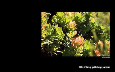
Blog Header Image Tartarus Caves
Monday, December 29, 2008
Steenbras River Gorge is perfect for a pic-nic and a swim
Hiking Trail: Steenbras River Gorge
Name of Reserve / Area: Kogelberg Biosphere Reserve, Steenbras River
Nearest Town: Located between Gordons Bay and Hangklip
Province: Western Cape
Country: South Africa

Duration of hike: 3 hours max.
Best time of year to go: Any time. Go very early in summer, as it gets very hot in the valley.
Fresh Water: the main watersource is the Steenbras river. I would not drink the water coming from the little lakes, as people swim in them.
Difficulty: Mike Lundy Rating 2B. Its flat all the way in the valley, but as you head past the 3rd lake, the climb is steep for about 30 min.
Pets: No pets are allowed.
Directions to get there: From Gordons Bay, take the coastal road towards Betty's Bay. You will soon drive over a very big bridge (the Steenbras River). This is your landmark and where you will see a parking area on your right.
What costs did you incurr to do this hike: Entry fee is 15 ZAR per person.
Pics taken by: Alex Aitkenhead and Juanita Welgemoed
(Click on the images for a larger view)

Here I did a Google image and mapped out the route in red. The red arrows indicate the 3 main lakes as you approach the cliffs.

There is a small hut by the entrace where you need to show your Permit. Permits can be bought from the Sunbird Guest Lodge (far left in pic above).
Phone: (+27 21) 856 1740 / Fax: (+27 21) 856 2116
Email: info@thesunbird.co.za

There is no need for a map or guide on this hike, as its is only one path leading up to the lakes. At some stage the paths become a mish mash of paths, but they do all come to the same destination.

This (pic above) was the first small lake which is in the river bed.

A short while after you start to climb, you will come accross the second lake with a beautiful waterfall.


The pic above is the highest one of the 4 lakes on this route.

This is the view from the top of the cliff, looking down onto the third (on the right) and fourth (on the left) lakes.

We started to climb the cliff and went all the way to the top. One of the most obvious things for me on this hike was the lack in maintenance of the paths. People have trampled the paths and eroded the area that it was very difficult to see which path was actually the main path to take. I can also see that its all been done without bad intention - due to the lack of guidance as to which paths should actually be taken. In the end they all come out at the same place.

At the top of the cliff the land is barren, rocky and pretty boring. It really is not worth your while to scramble all the way to the top if you wish to hike any further - unless you just want to enjoy the view and the flora.

Hikers Ratings: (Juanita) I really enjoyed the fact that I was able to walk inside a riverbed again. This made me think back of my days as a child when I played in the river on my dad's farm close to the Kruger National Park. The four little lakes were great places for a pitstop or a chill-stop. This seemed like a very popular local spot for a pic-nic and a swim on a hot summers day. I would not recommend that you go further than the top lake, as the path becomes blurry with loads of loose rocks and it could be dangerous.
I think I have been spoilt since I started hiking with regards to being exposed to excellent hiking routes / conditions. Sadly this Reserve's paths have been poorly maintained (very much unlike Table Mountain National Park who's paths are in almost perfect shape!). Just a small amount of effort from the local authority with a few sign posts errected to guide a person, would save this route from being erroded any further.
Name of Reserve / Area: Kogelberg Biosphere Reserve, Steenbras River
Nearest Town: Located between Gordons Bay and Hangklip
Province: Western Cape
Country: South Africa

Duration of hike: 3 hours max.
Best time of year to go: Any time. Go very early in summer, as it gets very hot in the valley.
Fresh Water: the main watersource is the Steenbras river. I would not drink the water coming from the little lakes, as people swim in them.
Difficulty: Mike Lundy Rating 2B. Its flat all the way in the valley, but as you head past the 3rd lake, the climb is steep for about 30 min.
Pets: No pets are allowed.

Directions to get there: From Gordons Bay, take the coastal road towards Betty's Bay. You will soon drive over a very big bridge (the Steenbras River). This is your landmark and where you will see a parking area on your right.
What costs did you incurr to do this hike: Entry fee is 15 ZAR per person.

Pics taken by: Alex Aitkenhead and Juanita Welgemoed
(Click on the images for a larger view)

Here I did a Google image and mapped out the route in red. The red arrows indicate the 3 main lakes as you approach the cliffs.

There is a small hut by the entrace where you need to show your Permit. Permits can be bought from the Sunbird Guest Lodge (far left in pic above).
Phone: (+27 21) 856 1740 / Fax: (+27 21) 856 2116
Email: info@thesunbird.co.za

There is no need for a map or guide on this hike, as its is only one path leading up to the lakes. At some stage the paths become a mish mash of paths, but they do all come to the same destination.

This (pic above) was the first small lake which is in the river bed.

A short while after you start to climb, you will come accross the second lake with a beautiful waterfall.


Below is a small video clip of the girl jumping into the lake

The pic above is the highest one of the 4 lakes on this route.

This is the view from the top of the cliff, looking down onto the third (on the right) and fourth (on the left) lakes.

We started to climb the cliff and went all the way to the top. One of the most obvious things for me on this hike was the lack in maintenance of the paths. People have trampled the paths and eroded the area that it was very difficult to see which path was actually the main path to take. I can also see that its all been done without bad intention - due to the lack of guidance as to which paths should actually be taken. In the end they all come out at the same place.

At the top of the cliff the land is barren, rocky and pretty boring. It really is not worth your while to scramble all the way to the top if you wish to hike any further - unless you just want to enjoy the view and the flora.

Hikers Ratings: (Juanita) I really enjoyed the fact that I was able to walk inside a riverbed again. This made me think back of my days as a child when I played in the river on my dad's farm close to the Kruger National Park. The four little lakes were great places for a pitstop or a chill-stop. This seemed like a very popular local spot for a pic-nic and a swim on a hot summers day. I would not recommend that you go further than the top lake, as the path becomes blurry with loads of loose rocks and it could be dangerous.
I think I have been spoilt since I started hiking with regards to being exposed to excellent hiking routes / conditions. Sadly this Reserve's paths have been poorly maintained (very much unlike Table Mountain National Park who's paths are in almost perfect shape!). Just a small amount of effort from the local authority with a few sign posts errected to guide a person, would save this route from being erroded any further.
Dogs and Hiking

Table Mountain National Park is one of the few National Parks in South Africa where you are permitted to walk a dog. However dog walking is restricted to limited areas in order to minimize the impacts of dogs on the biodiversity of the mountain – these include running off the paths and chasing indigenous animals.
Dogs must be under the control of their owners at all times and it is illegal for dogs to be on the mountain unaccompanied. Popular areas for dog walking are Silvermine, the lower slopes of Table Mountain accessible from Constantia Nek and Tokai Pine Plantation.
Please download the Dog Walking Environmental Management Plan for details on the designated areas.
Dog Walking also carries an annual permit fee of R50 which is attached to the purchase of a WILD Card. For WILD Card and permit information call Table Mountain National Park at their offices in Westlake, Cape Town on: 021 701 8692
Source: sanparks.org
Saturday, December 27, 2008
Beauty is in the eye of the beholder
This image on a large screen is a bit busy, which is why I have done it this way for you to use as a wall paper if you would like to make use of it. Its so beautiful, you cant begin imagine the unlimited beauty one experiences on hikes, let alone through the eye of a camera lens!

To save above image on your desktop, do the following:
- right click on image
- open in a new window / new tab
- right click on image again
- save as desktop / wall paper / back ground (depending on your software version)
Friday, December 26, 2008
Tackle Lions Head if you are first timer to hiking

Hiking Trail: Lions Head
Name of Reserve / Area: Table Mountain National Park, Lions Head
Nearest Town: Cape Town CBD and Camps Bay
Province: Western Cape
Country: South Africa
Best time to go: All year. Go early in summer. No shade during mid day.

You do not need a guide book or a map. The route is straight forward as long as you continue to go in an upwards direction. There are other paths running down along side the mountain.

Fresh Water: No water, bring your own.

Difficulty: Easy walk for the whole family, no exposure to hights. Will work up a light sweat.

Pets: You can take your small dog all the way, but you can not take your large dogs further than the steel step ladder. Small dogs need to be lifted up and down at some places. Please remember that your dogs also need water given to them whilst hiking. If you get thirsty, the chances are that they are about double as thirsty. The doberman did not want to drink water, we had to force him to drink on another hike as he was not used to drinking from a strange bottle. My dogs do drink from the bottle, because I have trained them to do so, which is not a problem for me when I go with them.

How safe is it: It is not recommended that you go alone. Keep a mace spray on you for extra
protection. Do not display your gadgets publically. Muggings have taken place here in broad daylight inbetween the crowds.
protection. Do not display your gadgets publically. Muggings have taken place here in broad daylight inbetween the crowds.

Directions to get there:From Cape Town city centre, drive up Buitengracht, which becomes Kloof Neck right to the top. As you are about to go down the hill, turn right into Signal Hill drive. Soon you will see the entrance to Lions Head on your left.

Pics taken by: Alex Aitkenhead, Juanita Welgemoed.

Hikers Ratings: Juanita - This was also one of the first hikes that we went on. As for for the first time it was a real treat to enjoy the stunning views of Cape Town City and surrounding subburbs this short walk had to offer us. Ive been on so many nice walks since this walk, I will only go back to this if someone asked me to join them. (been there, done that, yawn) Its very short and very busy, sometimes too busy. Trainstation comes to mind on a busy day.

There are some steel step ladders to climb and also a chain for those who want to take the short cut.

The alternative route is just as easy and there is no need to be concerned that you might miss out on anything.


People often go up to watch the sun set. Something I will not attempt unless Im in a large group, as there are many muggings along this route.

The pic above is a pano shot of the view from Lions Head towards Robin Island, Signal Hill, Cape Town and Table Mountain.
Thursday, December 25, 2008
Flowers for a Wallpaper

Herewith some pictures you can use as a wall paper on your desktop.

How to save as a wallpaper on your pc:
right click on the image
Open in a New Tab / New Window
right click on image
save as a desktop / wallpaper


How to save as a wallpaper on your pc:
right click on the image
Open in a New Tab / New Window
right click on image
save as a desktop / wallpaper

Flowers closed due to the cloudy weather, ontop of


Helderberg Mountain in Somerset West
Wednesday, December 24, 2008
Muizenberg Cave, Tartarus Cave, Spes Bona Valley

(click on above image for enlarged version to appreciate it for what it has to offer!)
Hiking Trail: Muizenberg Cave, Tartarus Cave, Spes Bona Valley
Name of Reserve / Area: Table Mountain National Park, Silvermine (East)
Nearest Town: Muizenberg and Kalk Bay
Province: Western Cape
Country: South Africa
Best time to go: All year. Go early in summer. Good shade in Spes Bona Valley.
Fresh Water: Water is available, but quality uncertain, bring your own.
Difficulty: Easy but steep incline, no exposure to hights. Caves are tricky and narrow. Will work up a sweat.
Pets: Can take your small dog on a leash, but not advisable if you entering the caves.
How safe is it: It is not recommended that you go alone. Keep a mace spray on you for extra protection. Do not display your gadgets too publically.
Directions to get there: Once you in Muizenberg, drive towards 110 Boyes Drive and park your car. Make sure to respect the local driveways. (Boyes Drive runs above and parallel with the main beach road at the bottom of the mountain.) The hike starts by the Ou Kraal sign. Remember to bring along a decent torch and a candle for the caves.
 Pics taken by: Alex Aitkenhead, Juanita Welgemoed, Iva Lopes de Sarria.
Hikers Ratings: Juanita - Loved this hike for everything it had to offer me. The awesome views of Muizenberg beach, the amazing discoveries of the caves and the highlight of the fairytale Spes Bona Valley.
 Cross over the seasonal stream and immediately turn right onto steep steps which will zig zag their way up and then along towards the direction of Muizenberg Beach.
 Once you reach a fork, keep left to continue going up into Bailey’s Kloof. The right option will however take you down towards Boyes drive again - which is where you dont want to go right now.
(click on above image for enlarged version)
There are many cross paths along this walk and its easy to get yourself confused. From this point, keep focussing to go upwards and towards the highest peak - St. James Peak. Your main landmark for now is to reach the first stone cut trig beacon about 20 min from this point - in the pic below.
 Once you’ve reached the end of Bailey’s Kloof (pic above), you will come to another cross path.Dont turn left, (the more prominent/obvious path to take as seen in the pic below) keep going right,
  then soon thereafter, the path will fork again. This is where you go left and head up towards the peak (and not right to follow the path again alongside the mountain towards Muizenberg Beach) into Mimetes Valley.
Its very easy to get yourself lost and confused on this track, which added about 30 min to our hike. We made the mistake of going left at the first path, and took the long way. Either way, they both reach the Jeep Track. I would recommend that you continue to follow your nose in an upward direction towards St. James peak until you reach the Jeep Track and a landmark of a cut stone beacon.
(In the pic below:
The stone cut trig beacon which you need to look out for, is in the centre of the pic, 1 is the path you will be coming from, 2 is the path to go and explore Muizenberg Cave, and 3 is the route you will return to and follow towards Tartatus Cave. )

(click on above image for enlarged version)
At this point the Jeep Track is a clear triangle of roads leading to one another. Facing the beacon, with the highest peak (St. James Peak where Muizenberg Caves are - see the pic below) behind you, also indicates the direction of the path you should follow to view the Muizenberg Caves inside St. James Peak.
 A short walk up this Jeep Track, will lead you to a path on the right (pic above) taking you into the massive magnificent cave. You are able to explore the Muizenberg Cave up to 40m into the mountain.

 Make sure you have a torch and a candle to ensure a reserve in case of dropping or losing one whilst exploring this cave.
 Track back towards the stone cut beacon, where you came from. Now take the left of the 2 Jeep Tracks heading upwards.
Soon you will see a marker on your left (indicating the direction to the Amphitheatre), which is a sandy track towards Tartarus Cave.

 This path has the most magnificent views.
 Be sure to keep looking back as you will notice (as in the pic below) a reverse view of the table top of Table Mountain – a view not seen too often at this angle.
 This sandy route will offer you various awesome rock formations for a pit stop of stunning views to take a break prior to your exploration of Tartarus Caves.
 The cave does not look like much from the outside, a mere 1.5m wide hole in the ground. We were very brave and entered the soon to discover abyss of darkness, narrow alleys and stunning discoveries. Being in a large group of 6 people and not enough light, we decided to turn around at about half of the way and headed back to the exit point.
Alex managed to capture these stunning shots inside the cave without a flash! ...its also not easy to hold the camera so still with such a slow shutter speed.


(click on above image for enlarged version)

 So far, we felt like children discovering treasures never seen before – guided by our secret map (Mike Lundy’s Best Walks in the Cape Peninsula)!
 Once we exited the cave, we headed upwards for about 5 min walk towards Kalk Bay Mountain (beacon in pic below) and then down into Spes Bona Valley.
 At the top of Spes Bona Valley you will reach a cross road, this is where you turn left down into the valley.
 Another discovery of a boardwalk almost the entire way down through a dense yellowwood and milkwood forest brought yet again the child out in me.
(click on above image for enlarged version)
 At the end of the boardwalk, you will again reach the Jeep track (which you crossed a few times before at other spots on the mountain), turn right onto the track. About 5 min walk turn left onto a narrow path heading you back towards the start of the Ou Kraal route. From here is a comfortable 30 min walk back to your car parked by 110 Boyes Drive alongside the mountain.
Subscribe to:
Posts (Atom)